 |
|
 Not to be confused with Cadbury Hill near Burnham, also in Somerset or
with Cadbury in Devon N.E. of Exeter.
Not to be confused with Cadbury Hill near Burnham, also in Somerset or
with Cadbury in Devon N.E. of Exeter.
An archaeological excavation of the hilltop at South Cadbury in 1967 examined
the possibility of the site being used in what are hypothesised to be Arthurian times (mid 500's)
i.e. the 'Dark Ages'. The site was occupied for 1600 years from the Iron Age when four ramparts
were built, the top rampart being thirty feet high.
In mid July 1967 the director of the dig, Leslie Alcock found evidence for
a wall which had been built in the Roman0-Saxon period (500's). In front of
the wall lay a stone-lined ditch.
A stone wall measuring five feet wide and ten feet high was located as the last
of the five ramparts. This wall was probably added to in A.D.1010 this
later addition is definitely of Saxon construction. A thirty foot length of
this wall was uncovered during the 1967 season.
Below the wall are defences erected by the Durotriges which were erected against the Romans in A.D.
45 when
Vespasian's 2nd Legion attacked the hill fort. There does not seem to have been any evidence
to show that it was attacked in the real sense of the word, the Romans may
merely have entered by the south-west gate and systematically burnt the area.
The evidence for this burn lies beneath the wall built in the 500's and thus
predates the wall. The wall has been used as a field boundary evidenced by
plough scars which have been found on the bedrock, are parallel to the wall. Pottery from the 500's was discovered in a bank of earth piled up against
the stone wall. As found at Tintagel, this was a Mediterranean type of pottery so it was surmised
that the owner would have been wealthy. The probability is that during the Dark
Age period the site was occupied by a local ruler in what is now Somerset but
then would have been associated with the Sumorsaete people who as
Roman-Britons would have been Christian whereas the invading Saxons were
pagans until conversion in the 600's.
attacked in the real sense of the word, the Romans may
merely have entered by the south-west gate and systematically burnt the area.
The evidence for this burn lies beneath the wall built in the 500's and thus
predates the wall. The wall has been used as a field boundary evidenced by
plough scars which have been found on the bedrock, are parallel to the wall. Pottery from the 500's was discovered in a bank of earth piled up against
the stone wall. As found at Tintagel, this was a Mediterranean type of pottery so it was surmised
that the owner would have been wealthy. The probability is that during the Dark
Age period the site was occupied by a local ruler in what is now Somerset but
then would have been associated with the Sumorsaete people who as
Roman-Britons would have been Christian whereas the invading Saxons were
pagans until conversion in the 600's.
 |
| Ordnance Survey map of south Cadbury Hill Fort. |
 A bronze Saxon brooch from the 500's was also discovered. This brooch
depicts a warrior wearing a helmet. It is suggested that this may be part
of the booty from an attack on Saxons living further to the east. Tradition
has it that Arthur was established on this site at Cadbury while other claims
are made for Tintagel in Cornwall, 108 miles distant from South Cadbury.
A bronze Saxon brooch from the 500's was also discovered. This brooch
depicts a warrior wearing a helmet. It is suggested that this may be part
of the booty from an attack on Saxons living further to the east. Tradition
has it that Arthur was established on this site at Cadbury while other claims
are made for Tintagel in Cornwall, 108 miles distant from South Cadbury.
Another site for Camlann has been proposed at Camboglanna,
here, archaeological evidence suggests that it was occupied in the 500's
by the Romano-British. Camboglanna lies not far from the great medieval
fortress of Carlisle, castled by William II [Rufus]. To the North of Carlisle
just within Scotland lies Arthuret, deciphered as 'Arthur's Head' where some
believe King Arthur is buried. Certainly Carlisle Castle could have been equated
with the romantic
'Camelot' in the medieval period. The Eden valley also has a long tradition
associated
with Arthurian romance. It was from the Eden valley region in the 1100's that Hugh II de
Morville, Lord of Appleby and forester of Inglewood took a copy of an Arthurian
tale to Austria whilst acting as a hostage for the release of Richard I.
This copy passed into the hands of Ulrich Von Zatzikhoven whence Chretin
de Troyes popularised it as Morte d' Arthur in North East France before
it was reintroduced into Britain during the later medieval period.

South Cadbury ramparts looking towards Parrock Hill |

Northern ramparts which would have been topped by a wooden palisade |
| The Battle of Mount Badon according to: Bede in Ecclesiastical History of English Nation, the Battle of Badon took place about 493. Nennius placed the date as 516. Badon was significant because it held the Anglian and Saxon advance for forty years. Arthur and Medrault's last battle is recorded at 'Camlann' in 537. |
Following the Battle of Mount Badon there elapsed 40 years of peace
between the Romano-Britons and the invading Angles and Saxons. It is possible
that the Saxons befriended the occupants of Cadbury. Either way it would appear
that South Cadbury sat near the disputed territory of the Britons and the
Saxons.

|
 |
| South Cadbury hill fort as it may have appeared |
On a clear day Glastonbury Tor, 11 miles away, can be seen from the top of
Cadbury hill fort. In the 1890's, between South Cadbury Castle and Glastonbury Tor to the
N.E., lay a bridle path called "Arthur's Lane, which is believed to have originally
been founded as a Neolithic causeway into the Glastonbury marshes2.
Within the rampart enclosure the site of a possible Romano-Celtic temple
was identified. If this is a temple then it is unlikely that the wall was
built before the 400's. The hilltop was probably refortified in the first
half of the 500's. A Roman arrowhead, two fragments of Roman roofing tile
and some tufa were found in the supposed sixth century wall. Other Roman temples
occur at:
Maiden Castle, Dorset (23 miles away)
Lydney, Gloucestershire
An earlier excavation in 1966 unearthed a gilt bronze letter "A' which may have come from a votive tablet at a temple site.
 |
| The site of the Cadbury hill fort gate in the N.E. rampart |
 |
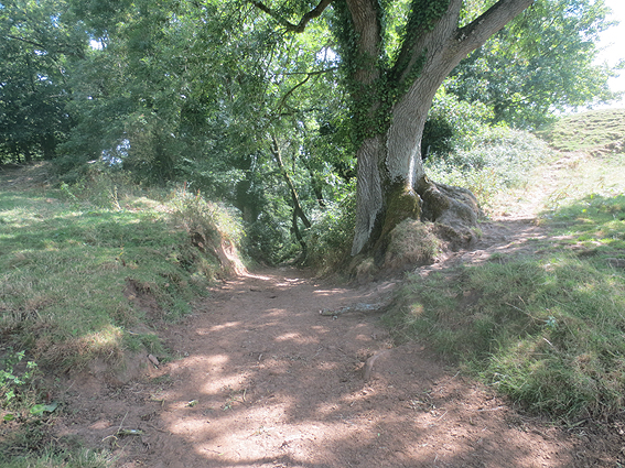
| The descent from the site of the N. E. hill fort gate |
 |
| The 'Camelot Pub', South Cadbury |
![]() Home | Previous Page | Next Page
Home | Previous Page | Next Page
References:
1. Dunn, Cyril. Article in The Observer, 13th August 1967,
2. Hill, Helen. The Realms of Arthur, 1970.
3. Alexander, Marc. A Companion to the Folklore, Myths & Customs
of Britain. Sutton Publishing. 2002