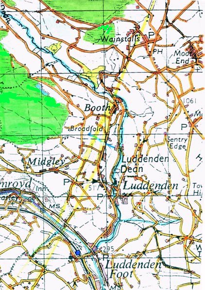
The Village
of Midgley near Halifax
Mentioned in Domesday Book 1086.
INDEX
Early History
Midgley near Halifax lies below Midgley Moor at an elevation
of 230 metres in the parish of Halifax in the Liberty of Wakefield.
The settlement is one of a number of hill top villages which also
gives its name to the township of Midgley. The place name may be derived from
the fact that the mid-level topographical shelf between the valley floor and the
moor tops allowed for fields to be established here as 'middle fields',
hence Midgley, middle ley.
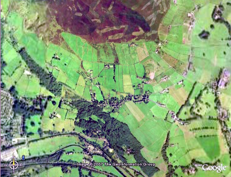
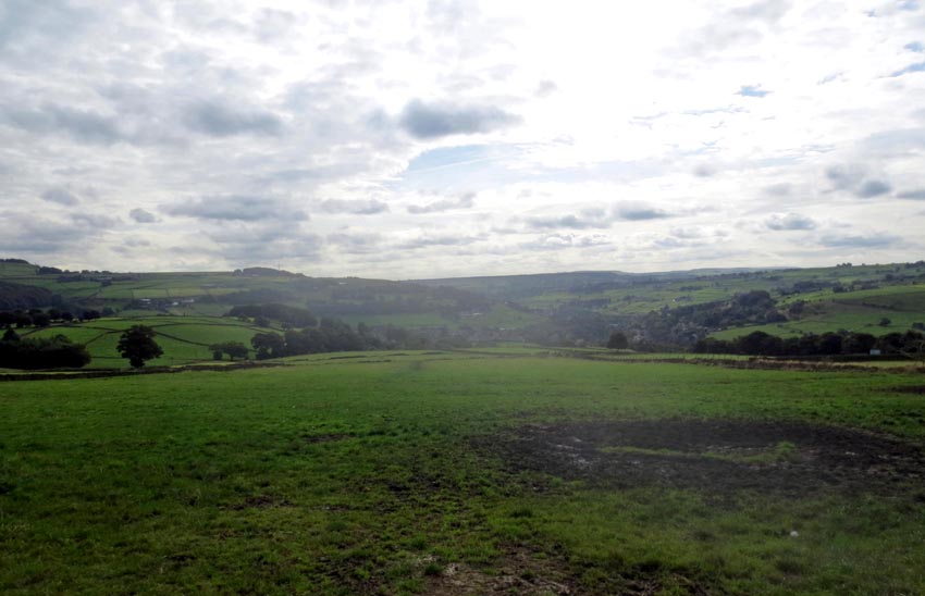 |
| A field on the Midgley terrace above Calderdale
which may have given rise to the Domesday Book name of 'Micleie'. The
valley of Ludenden Dean can be seen to the left and Calderdale to the
right. |
There is evidence on Midgley
Moor of Neolithic and Bronze Age remains such as "Churn Milk Joan", the
"Greenwood Stone", "Miller's Grave" and "Robin Hood's Penny Stone" [See below].
There is a hamlet of Midgley further east near Wakefield which
appears to have formed part of the honour of Pontefract well after the Norman
invasion, however the Midgley settlement in the Halifax locality was part
of the western division of the manor of Wakefield. The name appears in Domesday
Book as Micleie.
Domesday Defined
Other spellings include, Miclei, Miggeley, Miglay, Miggely, Migeley etc. Following
Domesday the name is then first recorded in 1207. See variations in d
minor. According to the author of the History of the Stanfields, Midgley in
1885 was pronounced as 'Mig-ge-ley' by local inhabitants. [History
of the family of Stansfeld of Stansfield in the parish of Halifax and its
numerous branches, p.
6.] This appears to be close to the phonetically spelt 'Miclei' of the
Domesday Book.
Lying on the north side of the river Calder the township was bounded
on the west by Foster Clough and on the east by the Luddenden stream. One
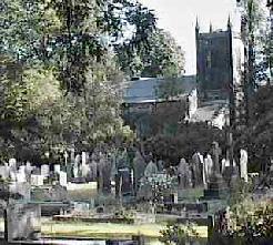
of the oldest churches in the area (St. Mary's ca.1620) in the village of
Luddenden lies within its boundaries. It also has strong connections with
Methodism, John Wesley having stayed at Ewood Hall on numerous occasions.3
Midgley is sited at the convergence of the Calder Pass and the Roman
road from Manchester via Blackstone Edge to Ilkley and Aldborough.
This road appears to have been built A.D. 122-125 and replaced the road through
Castleshaw and Slack which was built earlier in A.D. 79-80. The Blackstone
Edge road is the road the Romans used to transport lead from Greenhow
Moor near Pateley Bridge in the northern Pennines, south past Midgley where
it is now sited, down the steep Blackstone Edge where the incline is still
cobbled with large stone blocks. The road would have also been a frontier
and rapid transport route for troops into the Brigantian highlands. This
road was being constructed at the time Hadrian's wall was being erected which
was a time of increasing raids from the Picts (Selgovae, Damnonii and Venecones)
in Northern Britannia, not yet an area politically distinct from Southern
Britain until settlements were established around the Clyde by the Scotii from
what is now Northern Ireland.
The Romans did not use the obvious east-west passage offered by the
Calder Pass which could be easily attacked by bands of Brigantian warriors
sweeping down from the surrounding moorlands, but preferred a direct line
to Aldborough (Isurium Brigantium) in the north. This road somewhat paralleled
the one from Manchester and Chester through Castleshaw, Pule Hill, Slack
(Camulodunum 80-140A.D.) Cleckheaton (Cambodunum) to York (Eboracum).
The Romans were losing control earlier here than in the rest of Britain
towards the end of their occupation. Roman signal stations were still manned in the closing years
of the 300's on the Yorkshire coast to give alarm at the approach of the
Anglian pirates. In the early 400's troops were withdrawn to defend Rome when
in 410 the emperor Honorius wrote to the British towns telling them to defend
themselves and the garrison at York was ordered back to the continent.
Anglian Incursions
Aethelfrith is likely to have made incursions into the district with
the withdrawal of the Roman garrisons and decay of rule. In
617 he moved rapidly down the Roman road from the North Yorkshire Wolds
and York through Slack, Castleshaw and Manchester to achieve a decisive battle
over the British at Chester. This battle separated the Northern British
[Strathclyde] resistance
from the Welsh British forces [Powys] and allowed the Anglians to control the West
coast of what is now Lancashire.
In 620 Edwin struck at the small British Kingdom of Elmete and
colonisation in the West Yorkshire region probably became effective from
this time. Anglian townships or villages would have begun to appear first
along river banks with later groups progressing further inland. The navigable limit on the Aire, Calder etc. would have limited the
passage by ship, thus the earlier settlements are seen as being downstream.
However it is recognised that early settlement by Anglians occurred in
the Yorkshire Wolds and incursions may have occurred from here.
By 1050 the region was under the direct control of Edward ("The
Confessor"), we know this because William I took them over as his own and
gave the lands to De Laci and Warenne. Earl
Warenne was found to be
earl at the time of Kirby's Inquest [1296]. In 1316 [Nomina Vilarum] 'Miggeley'
is recorded as belonging to the earl of Warenne who at this time was John
8th earl and it remained with him until it passed, with the manor of Wakefield,
to the crown3.
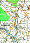
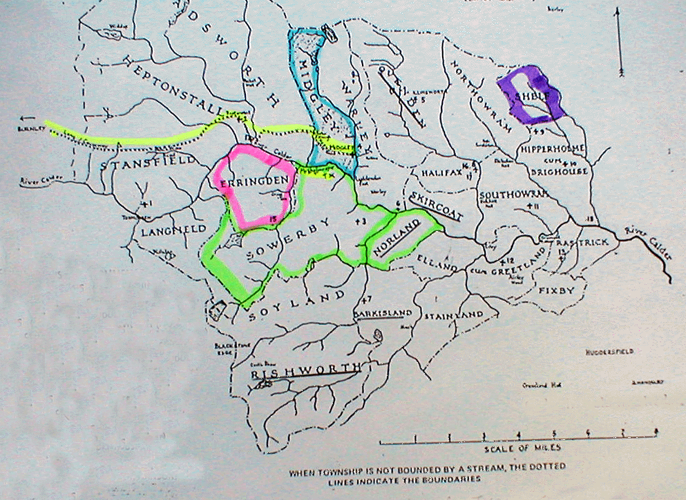
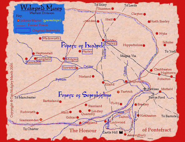
See map of The manor of Wakefield, Western Division
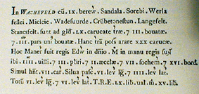
Midgley near Halifax, Miclei1 or Micleie2
is mentioned in the Domesday book (1086) as one of the
nine outlying sub-manors or beriwicks (berewics*) belonging to the lordship of Wakefield. By
the 1100's Migelaia2 is recorded for the hamlet of Midgley
near Wakefield. The name may have originated in Micel
or Mycel in O.E. and O. Scandinavian Mikill meaning
"great or large", The suffix -leah in O.E. means 'wood, woodland
clearing or glade', later a pasture or meadow.4. [*A berewic O.E. meaning 'a barley or corn farm and later an outlying
grange or demesne farm']
 Midgley commands a wide view across the Calder valley and had the advantage
that early Anglian settlers may have used the derelict Roman road for movement. As this line of communication further declined the haphazard pattern
of tracks now represented by local roads would no doubt have developed.
Some of these tracks may represent the boundaries of former fields. The
presence of baulked perimeters would support this. However John Franklin
Midgley states there is little evidence of these Anglian field systems [a
furlong or furrow long, 200 yards, and a chain wide 22 yards] Midgley commands a wide view across the Calder valley and had the advantage
that early Anglian settlers may have used the derelict Roman road for movement. As this line of communication further declined the haphazard pattern
of tracks now represented by local roads would no doubt have developed.
Some of these tracks may represent the boundaries of former fields. The
presence of baulked perimeters would support this. However John Franklin
Midgley states there is little evidence of these Anglian field systems [a
furlong or furrow long, 200 yards, and a chain wide 22 yards]

Field patterns
between Midgley and Luddenden |
 The
Medieval Manor and the half carucate conflation. The
Medieval Manor and the half carucate conflation.
An
error has been found in a note for a Calendar of inquiry post mortem26
which mentions that
John [III] de Meux held half a carucate in Midgley, near Halifax. However, a study of the
descent of this land from Emma Lascelles to her husband Peter de Birkin
to Isabel de Birkin shows that this is a reference to 'Little Midgley' near
Wakefield NOT Midgley in the parish of Halifax. After Isabel married Robert [I]
de Everingham (d. June 1246) this half carucate in Little Midgley descended
through the Everingham line to Robert I's grandson, Robert II de Everingham who
died in 1287 holding this half carucate as well as ten bovates in Sitlington. At
this time John III de Meaux was the tenant of Robert II for this half carucate.
Meaux was probably favoured in this arrangement as his grandmother Amice de
Everingham had married John III's grandfather John II de Meaux. See
the evidence for this.
From the Wakefield Court Rolls for
1276,
Henry de Miggeley, son of Adam de Midgley, is recorded as having leased land at
'Riding'* in Ovenden from Sir John [II] de Soothill where he was permitted
to collect timber for burning from Ovenden Wood. [Y.A.J., Record Series,
Yorkshire Deeds, vol. 2.] * Now located by Ridings Bridge and
Lane, parish of Ovenden.
From
the W.C.R's the early Midgley [Miggelay, Migge, Miggele, Miggeley, Miggelay]
pedigree may be determined as follows as:
Midgley of Sowerby
Soothill of Soothill
William
1296
Reginald ~ 1200
|
|
Adam
*
Sir John I ~1198-1266===Alice
|
|
_______________
__________________
|
| |
|
Henry+
John Thomas
Sir John II b. ~1250 d. ~1310
1274 - Forester of the forest d.
1326
|
of Sowerby, resided Hathershelf Sir
Henry+ a retainer of earl Thomas
mentioned 1274-1298, 1308, 1321.
b. ~1278 d. ~ 1352
*
Mentioned 1274, 1275 and in 1297 he was the Grave for the
Graveship of Sowerby.
+
Leased land from Sir John II de Soothill who in turn was a tenant of Earl
Warenne.
+
Pardoned in June 1322 for his rebellion with Earl Thomas.
At some point,
perhaps during the rebellion of Thomas earl of Lancaster, and after the death of
Godfrey de Meaux [between August 1309 and February 1311], the half carucate was
perhaps granted by earl Thomas to the Soothill family, where, from a Soothill
i.p.m., they are found to be in possession in 1326.
FREE WARREN
In 37 Henry III
[1253] John 7th
earl Warenne [d. 1304] was granted free warren in Midgley while John 8th
earl, his grandson is later mentioned in Kirkby's Inquest [~1296] holding
Midgley as part of the manor of Wakefield.
It
should be noted that there was no person with the surname Midgley as lord of the
manor of Midgley at or after the Domesday Book [1086], although there may have
been some control by predecessors in the the manor before the Norman Conquest
[1066]. Midgley branches later became lords of Thornton
[Headley Hall], Bradforddale and Haworth.]
probably following the dissolution of the monasteries when land became available
for purchase thanks to good old 'King Hal'.
Descent
of the lords of the manor of Midgley
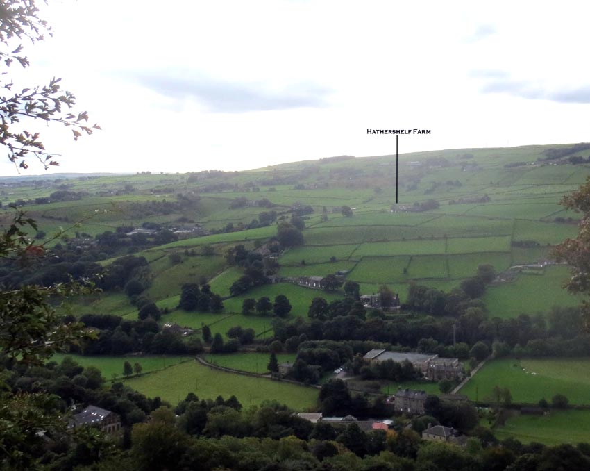 |
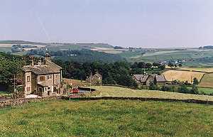
| Hathershelf Farm today as seen across the Calder
Valley from Towngate, Midgley.
In medieval times the summits of the Pennine foothills would have been
part of the forest of Sowerby |
This Midgley branch seem to have become settled at Hathershelf [Hadreschelf]
but by 10
Ed. II [1317-1318] the Hathershelf vaccary pasture had been granted to Earl
Warenne's steward, Henry de Welda:
22nd August 1316 at York -
Confirmation of a grant made by John de Warenna, earl of Surrey, to Henry de Walda (Welda) of all the land which Philip de la Wodehalle sometime
held from the ancestors of the earl at la Wodehalle (Woodhall), in the parish of Wakefeld, and which Robert Gunne lately held from the earl at fee farm, and of two parts of all lands with woods, meadows, feedings, pastures, moors, rents and services which John le Barn formerly held of the earl in villenage at Tothille
(Toot Hill, S.W. of Sowerby) in the parish of Halifax, together with the reversion of the remaining third part thereof which Beatrice, sometime the wife of the said John, holds in dower; and also of the grant which the earl made to the said Henry of all his pasture in Sourby (Sowerby), co. York, which is called
'Hardteschelf,' (Hathershelf) and of the entire meadow which he held in Thornes
(S.W. of Wakefield), called 'Pampellion Holm,' and of the grant which the earl made to the said Henry of the manor of Doltonwode
(Dalton Wood near Dalton, east of Huddersfield town centre), with its pastures and woods. By K. [C.P.R., 1313-1317, p. 535.]
Welda probably almost immediately lost the property because in
1318 John de Warenne quit claimed all of his Yorkshire manors to Thomas earl of
Lancaster who would then have replaced Welda with his own man. After Edward
III's accession the manor of Midgley may have reverted to John de Melsa
(son of
Godfrey) who died in 1353 [26 Ed. III] having left
John, son of Thomas de
Den+, of
Midgley [John and Thomas de Midgley?], all the land and meadow, &c. which John, the son of Thomas, held by charter in Myggeley, from Lyddingdenhead [Luddendenhead], &c.
30 Ed. III [1357].29 + Possibly of Luddenden
i.e. Luddenden Dean.
This
Thomas de Den of Midgley who it is surmised became Thomas de Midgley may be the
same person mentioned in the Stansfield family genealogy whose daughter Agnes
married an Edmond de Stansfield. Thomas is described there as 'alias Mr. Thomas
Midgley' who bore as his arms 'sable two bars gemmelles or' [Harlian Ms.] However the author of the Stansfield family adds to these arms 'on
a chief of the second, three catherine wheels of the first'. These are the
identical arms to those of the Midgleys who later moved into Rochdale, Lancashire as
cotton millers, the catherine wheels possibly being mistaken for mill wheels.
In
an undated deed there is a transfer of land from 'Agnes at the Gate of
Northowram' to John de Tothill. The witnesses are John de Midgley [probably the
forester of the forest of Sowerby], Hugh de Eland (d > August 1324, John de
Lacy (of Cromwell Bottom, d. 1307-1310), Henry de Rishworth, Thomas de Copley
and John de Haldeworth. These witnesses suggest that the deed is dated somewhere
between 1298 and 1310. It is implied in the Stansfield history that this Agnes
is the same as Agnes de Midgley who married into the Stansfields.
 |
| Click for enlarged map |
'After this, but whether by purchase or marriage is uncertain, it came to the family of
Sotehill; ........for there is (says Watson) the copy of a deed from Gerard de Sotehill, dominus de Midgleye, dated at Miegleye, 3 Oct. 1392, 16 Ric. II. By an inquisition of wastes within Wakefield, 19 Edw. IV. Gerard Soothill, Esq. was found to hold the manor of Midgley, by soccage, &c. and to render by the year 2s.
Soon after this it seems to be alienated; for Gilbert Lacy, esq. and Joan his wife, enfeoffed Richard Symmes, vicar of Halifax, and others in this manor, by deed, dated at Southowram, 12th July, 21 Edw. IV. but for what particular purpose does not appear, excepting that it was done with intent to have it conveyed to some one of his own family; for John Lacy of Brearley, Esq. was found in the year 1577, by inquisition at Wakefield, to be lord of the manor. Soon after this it came to the Farrers, by the intermarriage (32 Eliz.) of Henry
Farrer of Ewood, with Mary, daughter of the above John Lacy, and in this family it long continued.'
25
Midgley-Waterhouse-Farrer
zipped
gedcom Steve Riggan is descended from William Farrar who migrated to Virginia with Thomas West, 3rd Lord
de la Warre, in 1618. Proven by will, William Farrar was the 3rd son of John Farrar of Ewood Hall,
Mytholmroyd, West Yorkshire and his wife Cecily Kelke. John Farrar inherited Brearley Hall from his elder brother William Farrar in 1610 and passed it on his will 1627 to his eldest son John Farrar while
Steve's William inherited land in Hertfordshire as the family had moved into London by this time.
Steve's ancestor returned to England in the 1630s after his fathers death to liquidate his inheritance to his brothers as proven in records. He returned to America and was dead by 1637 as proven in Virginia records. William Farrar of Virginias grandparents were William Farrar of Ewood and Margaret Lacy, daughter of Hugh Lacy of Brearley Hall and Agnes Savile of New Hall, Elland, Yorkshire, daughter of Nicholas Savile who was descended from Sir Simon Thornhill of Thornhill.
Contact: Steve Riggan - Updated email
14 June 2019
At some point after the Soothills held the manor, the Meux
family appear to have regained the manor of Midgley. This is indicated when on
12th April 1379 Thomas de Meaux of 'Belynghay' knight to John Aunsell knight, his heirs and
assigns quitclaimed the manor of Miggeley co. York sometime of Sir John de Meaux knight son and heir of Sir Godfrey de Meaux knight. Witnesses: Sir Peter
VI de Malo Lacu [de Mauley], Sir Ralph de Hastynges [Hastings], John Bygod [Bigod], John Conestable[Constable] of
Halsham, Robert de Nevylle [Nevile, Neville] of Hornby sheriff of York, John Seyville
[Savile, Saville] knights. Dated York, Monday after Palm Sunday 2 Richard II.33
Lacy
genealogy [Word doc 2013 version]
Midgley
residents in 1379:
The poll tax lists for Yorkshire in the reign of Richard II
show that the surname had not spread very far in this county. The list of 1379
for the vill of 'Migelay' shows:
Johannes
Migeslay, Cissor [tailor] and his wife 6 pence.
Ricardus
de Miglay and his wife 4d.
Ricardus
de Migeslay 4d.
There are no Midgley surnames at this time in the rest of
Yorkshire unless we identify 'Johanes Miklay' and his wife at Kippax, 4d., 'Adam
de Miklay' and wife at Rawdon, 4d. and 'William de Metelay' in Rothwell, 4d.,
four pence being the standard tax rate for most residents. A later name
associated with that of Midgley occurs at Warley where 'Johannes Mergetrode' [Murgatroyd]
and his wife also had to pay 4d. Thus at this time there were no persons with
the surname of Midgley or variants thereof in later haunts such as Warley,
Sowerby, Halifax, Braddforddale, Adel, Arthington, Brayton etc.
Midgley
residents of Tudor Midgley and surrounding vills:
Subsidy Roll for Agbrigg and Morley 15 Henry VIII (~1524)
Vill of Midgley:
Hugh Lacy 20s. [Of Brearley Hall]
John Migelay 40s. goods 12d.
Alice Migelay ditto
Thomas Migelay ditto
Edward Migelay ditto
[Y. A. J., vol. ii, (1873), p.p. 57-58.]
Vill of Wadsworth:
William Migelay 3 pounds goods 18d.
[Y. A. J., vol. ii, (1873), p.58.]
Subsidy Roll for Skyrack 15 Henry VIII (~1524)
Vill of Horsforth:
Richard Megelay 8d. [Y. A. J., vol. ii, (1873), p. 290.]
Vill of Bingley:
Thomas Megelay for goods 20s.
Henry Megelay 4d. [Y. A. J., vol. ii, (1873), p. 291.]
Vill of Preston:
William Mytley for goods 2s. 6d. [Y.A. J., vol. ii, (1873), p. 294.]
Vill of Headingley:
Robert Megelay for goods 2s. 6d.
Richard Megelay ditto
John Megelay ditto
[Y. A. J., vol. ii, (1873), p. 295.]
Crossley's
Halifax Parish Wills37 provides us with another Midgley
family of the Tudor period, viz: Richard Midgley of Midgley who died
before 28 July 1555 and was buried at Halifax Parish Church. His wife was
Elizabeth and they had at least eight children:
Thomas, Margaret,
Richard Alice, Agnes, William, Elizabeth and Robert
Another
family, that of Richard Midgley of Midgley is recorded from the same
source.38 His wife was Jane and they had three children, John,
Thomas and William. Richard died before 20 December 1556 and like-wise was
buried at Halifax Parish Church. Witnesses to the will were: Richard Midgley,
Richard Midgley the younger, John Midgley (his brother) and a Richard Thomas.
The
other Midgley settlement sometimes called 'Little Midgley'
This township appears to pre-date another Midgley hamlet near Wakefield
which is first mentioned as Migelaia4 in the 1100's and
rendered as Miggelay in October 1238 in the Calendar of Close Rolls when
referring to William earl Warenne, Richard a tenant and Robert de Everingham and
his wife Isabella:
| Mandatum est justiciariis Hybernie quod in loquela que est coram eis inter
W. comitem Warrenn', petentem, et Ricardum de [. . .], tenentem, de j. carucata
terre in Miggelay unde idem Ricardus
vocavit ad [warantum] Robertum de Everingeham et Isabellam uxorem ejus,
procedant secundum legem et consuetudinem regni Anglie ad judicium inde
reddendum ad diem videlicet quem. [. . . .].
|
A descendant of Robert's, Adam de Everingham was ordered to
be to be distrained at the Wakefield Court on 7th July 1327 for arrears at
court regarding tenements at Erdeslawe (Ardsley) and Miggeley. [W.C.R.,
1322-1331, 2013, p. 124.]
In 1577 'Little Midgley' appeared as Mydgeley in Christopher Saxton's
map of Yorkshire. A later spelling in the 1700's recorded it as Mygeley.
Anyone with this surname today knows the exasperation of having
to spell it out for writers. It was not until lexicographers in the late 1700's such as Johnson began
to standardise the spelling of words and compulsory education was
introduced in the late1800's that accepted spellings evolved. Apart
from Webster's deliberate divergence from English as spoken in Mother England,
these changes may help explain the many spelling differences American English and native
English exhibit today, much of the migration to the Americas having occurred before dictionary
standardisation.
It might also be mentioned in passing that the popularity of English
over the Chinese language recently is in no small way due to communication
through the internet, a place that was originally reserved for Esperanto.
We have John Tindale, writer of King James' I's bible version to thank
for the simplicity of English with all its richness, John is quoted as wanting
to 'make the bible able to be read even by a ploughboy'.
Due to illiteracy, the place- and sur- name like many others was not
standardised but merely recorded by a second party in a phonetic style. We
see this in the way the Domesday scribes attempted to literate the local
Anglian pronunciations.
It would appear that if we try to pronounce say Miclei and Migelaia
they sound different. They may in fact be two derivations which have become
convergent in their spelling. Miclei could sound more like Migleah, with
a hard "g" as in granite, whereas Migelaia may have the softer "g"
as in gelignite! Whatever the original pronunciation the convergence
of spelling is only relatively recent and may explain the fact that
we have today two villages/hamlets in Yorkshire with ostensibly the same
name but different locations and histories. But see Sir William Midgley
Patronymic surnames that appear in the locality are Schepard, Paget,
Vornvall [Wormald], Dickonson, Fletcher [a person who made arrows], with other
toponymics such as Townend, Waldesworth
[Wadsworth], Okes, Saltonstall, de Burgh, Culpon and Lemanskill.
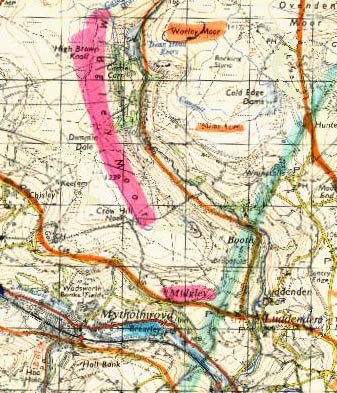
The village sits at a point where the steep sided Calder valley changes
to a broad open vista north towards Booth. The so-called 'Long Causeway', runs
from Burnley in Lancashire over the Pennines through Mereclough, following Keb's
Road to Hebden Bridge then through Midgley towards Sowerby and Halifax:.
 |
| Map showing the 'Long Causeway' and townships in the
area of Sowerby. Many of these townships [those underlined and others] were gained by
Jordan
FitzEssulf of Thornhill, in the 1100's, probably by marriage to an heiress
of lands in Sowebyshire. [Pontefract Chartulary] Most of these administrative areas were covered by the
now extinct medieval administrative unit of Sowerbyshire* well into the 1400's. In the late 1200's a John de Miggeley of
Hadreshelf near Mytholmroyd was the forester for Sowerbyshire for John the
7th earl Warenne. * Later called the forest of
Hardwick, though for what reason is unknown. |
'Hadreschelf' [Hathershelf] lies on the south side of the river
Calder almost due south and within sight of Brearley Hall. In 1315 Henry de
Welda [de la Welde/de la Walda]* steward
of John 8th earl de Warenne's manor of Wakefield & Wakefield
Castle [at Sandal Magna] was granted a pasture [vaccary] near Sowerby
called 'Hadreschelf' in 10 Ed. II [1317-1318].28 Today this is marked
by Hadershelf Lane west of Sowerby on which are located three farmsteads. Henry
was given this vaccary just before John lost his northern manors for in 1318
earl John quit claimed the castles of Sandal and Conisbrough along with estates
at Sowerby, Dewsbury, Halifax and estates in other counties which were granted
to Thomas earl of Lancaster which he held until 1322.
Known
chief foresters of the forest of Sowerbyshire:-
| Name |
Known to have been in office |
Notes |
| Geppe de Dene |
1288 |
Probably named after Luddenden Dean. [Samuel Midgley.
The History of he Town and Parish of Halifax, p. 48; J. Horsfall
Turner. History of Brighouse &c., p. 51.] |
| John de Miggeley |
1274-1298, 1308, 1321 |
Resided Hathershelf during the reigns of King Edward I
and II. |
| John Cockroft |
1379 |
Resided Wadsworth with his wife Christiana, he became a
notorious outlaw for twelve years until shot in 1291 with an arrow. |
| Sir John Savile |
1399 |
Granted under Richard II, confirmed under Henry IV, 2
May 1405. Chief forester of Sowerbyshire and Holmfirth and keeper of the
park of Erringden. [C.P.R., 1405-1408, p. 15.] |
| William de Holand |
10 August 1405 |
Son of Richard de Holand of Lancashire, possibly of Denton.
'Master forester of the park of Ayrendon [Erringden]and of
Sourebeschire [Sowerbyshire], late of the duke of York,* with all due fees and profits during the time that it is in the king's hands.'
[C.P.R., 1405-1408, p. 50]
* Edmund de Langley, son of
King Edward III and Queen Philippa held this forest before his death in 1402
. Edmund was married to:
1. Isabella of Castile
2. Joan Holland [dtr. of Thomas Holland 2nd earl of Kent and Alice
FitzAlan]
Thus it is possible that Joan Holland had some influence over Edmund to employ William de Holand as his forester. |
| John Pilkington Esq. |
1465 |
Chief forester of Edward IV's chase of Sowerby.
[Watson, John. The History and Antiquities of the Parish of Halifax.
pp. 74-75.] |
John
de Midgley is also mentioned on 22nd November 1274 as a surety for two men
caught skinning a stag on the forest of Sowerby:
Stephen le Waleys'* man, John of Asberne, was charged
with taking a stag in the forest of Sowerby. A man named Hulle was with
him. These two were discovered by Adam de Holgate son of Thomas to be
skinning the stag. Adam was fined 40s (or 4 oxen) for helping the two
men to eat the stag. John de Midgley and Adam de Wadsworth and Nalke of
Heptonstall acted as sureties for their good behaviour. The main
culprits had escaped but were to be arrested if found within Earl
Warenne's manor of Wakefield.40
*Probably Sir Stephen le Waleys of Burgh Wallis, S. Yorks. |
Intriguingly, John de Midgley, the forester was on the same day charged at
Wakefield for:
| 'taking a stag in Sowerby Forest and put himself
on a good inquisition at Halifax, or at Raistrick' |
Three days later on the 25th November 1274 at Rastrick a jury of forty
persons found John quit of taking the stag but he was also charged with having
received chattels i.e. four oxen and sixteen sheep from a fugitive thief. The
jurors swore on oath that as Earl Warenne's forester John was not able to have
any part of those chattels, because by an inquisition the king's coroner had
claimed them for the king. It has been suggested by John Lister, editor of W.C.R.
vol. 4, that this was not a trial for larceny but a procedure under Forest law.42
In 1307 the Sheriff's Court was held at the Moot Hall, Halifax while the jury (John de
Studley, Richard de Wadsworth and Adam de Midgley) complained that the Prior held his court four
times a year instead of twice.41 Adam was probably the same person as
Adam de Migge, found in the W.C.R., father of John the forester.
Brearley
Hall lies within the township of Midgley and is described as "an ancient mansion of the Midgley Family"5.
This
building's history is likely to hold many clues to the early Midgley
family which probably pre-dates the Norman conquest. It was supplanted by the Norman family Sotehill and known to be held
by this family in 1326 (Brearley Old Hall). However it would appear that the ownership entered the De Laci family,
records show that a daughter of the Sotehill's , Johanna Sotehill, married
Gilbert Lacy the second son of John Lacy. Gilbert Lacy's daughter married
Henry Murgatroyd. The Lord of Midgley in the early 1500's was a Hugh Lacy (a branch
of the Norman De
Laci family) who was born about 1489 at Brearley Hall and whose will
was proved in 1570. He had married Agnes Saville of the Savilles of Thornhill.'
Hugh and Agnes Lacy's daughter, Margaret, born abt. 1530 married William Farrer [yeoman born abt. 1514] their child was John Farrer esq. born about
1550 at Ewood Hall. Ewood Hall, is a single house with its estate
in the township of Midgley. *Of Wing, Buckinghamshire
where John de Warenne held an extensive property.
Download: Midgley-Murgatroyd-Waterhouse
genealogy connections [Word file 2013 vers.]
Early Industry
In 1371 a John de Midgley is recorded in the Wakefield Rolls as being
a constable for the township [the Yorkshire name for a village] of Midgley1.This
may be the same John de Midgley who is mentioned as having the occupation
of a "cissor" [tailor]. There is also a reference to a John Dente a "textor"
[weaver]. These two occupational terms bear witness to the early domestic
manufacture of woollen goods in the 1300's Initially the soft water used
for scouring the wool from the moors was the location factor but later
the coalfields of West Yorkshire conspired with water power to locate woollen
manufacture to the valley bottoms18.
John Hesketh hypothesises that the Midgley's of Barnsley originated
from the Midgley near Halifax. His reasons are that the linen industry
in Barnsley lasted from 1774 to 1957, and as this developed, local bleachers
encouraged cotton industry workers from Lancashire and Cheshire as well
as experienced weavers from the Halifax area to settle there.21
John Watson in "The Histories and Antiquities of the Parish of Halifax
in Yorkshire" 1775 states:
"The Midgley's of Midgley were once a family of some tolerable account
who owned much of the land in Midgley, but I can give the reader no better
pedigree of them than what we may meet in Thoresby's 'Topography' "
In a return for Midgley Township (1763-4) there were 217 families and
224 houses, seven being empty. It is estimated that if each family averaged
5 members per household there would have been 1,085 inhabitants. They were
mainly farmers (livestock, barley, rye oats and woollen manufacture- each
house had a loom and spinning wheel)
In September 1824 there were massive landslides in Luddenden Dean below
Midgley Moor.
During the 1830's a dispute occurred between Lancashire and Yorkshire
(not the first!) over the positioning of the county boundary to the north
of the township.
Neolithic and Bronze Age sites in Midgley
Township.
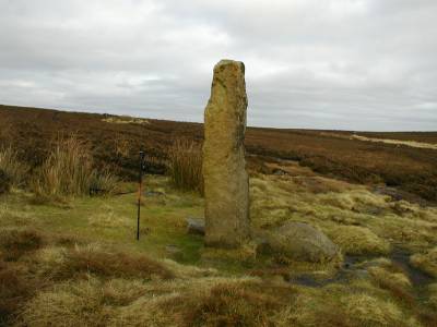
Churn Milk
Joan
Also known as Churn Milk Peg and Savile's Low, is located on Midgley
Moor. It is a 6' 9" high stone pillar -probably a boundary marker. The stone
is claimed to spin round three times on New Year's Eve. It is said to be
named after a milk-maid who died whilst carrying milk to the villages here.
Peter Evans speculates that this stone could have been erected by Danish
[Viking] settlers as delineating their lands. There is also a legend that a penny placed on the stone will bring good
luck, no doubt to the person that finds it!. Peter has found boundary marker stones at such places as Pole Stoop
and Sutton Stoop on Haworth Moor and a boundary stone on Oxenhope Stoop
Hill. The word Stoop originates from Old Norse meaning 'post'.
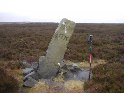
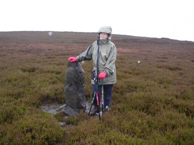
The Greenwood
Stone
This may be a property boundary stone named from the Greenwood family.
Malcolm Bull has it as erected in the 1500's to mark the boundary
between Midgley and Wadsworth townships. This was established following a
dispute which arose between Sir George Savile and John Lacy in 1594, both
Lords of the manor. The date 1779 has been cut into the west side, this occurred
after a beating of the bounds was carried out by Heptonstall Grammar
School. The stone is sited on Midgley Moor at Ordance Survey reference SE
017 285. The surface appears fresher and more angular which suggests this
later age. See The Knyght
at the Lee for the possible derivation of this name*. The Greenwood
standing stone is about 4-5 ft tall24. Peter Evans23
who has supplied the photographs describes this landmark as a "Roughly
dressed stone about 4ft high carrying an engraved date '1775', leaning badly
just a few yards away and slightly further North of a smaller stone".
Peter now finds that this smaller stone is no longer standing . This smaller stone at
SE 016 284 and the Miller's Grave
mound
are near the Greenwood Stone. Peter describes the smaller stone as
apparently a "standing stone from the Bronze Age, possibly at the centre
of a stone circle and probably recently re-erected".
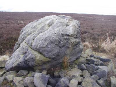
There is also what appears to be a glacal erratic22
at SE 018 284. "A stone of similar type and size to the large stones
capping Miller's Grave but partly broken up - it could be entirely natural
or it may be a Neolithic or Bronze Age standing stone. This is the closest
of the three stones to the Miller's Grave" and can be seen in the distant
background on the Miller's Grave photograph23 .
* Peter Evans who is making a study of standing stones
on the Pennines suggests that the Greenwood Stone is named after the Greenwood
family who built Stone House, Todmorden between 1746 and 1749. There
is a huge megalith which stands near the house but it is suspected that
it was erected along with others by the Greenwood family. The present owner
confirmed to Peter Evans that this was a "folly" of the 1700's-1800's. The
resident thinks the other two stones were erected by Icelandic settlers
[876-954 AD] after which the Danish/Vikings tended to erect stone crosses
to mark their lands. Peter also suggests that there may be a relationship
between The Greenwood Stone on Midgley Moor and this family. See Midgley-Greenwood
coat
of arms.
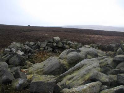
Miller's
Grave
This is a mound or tumulus on Midgley Moor which appears to have had
the overburden eroded leaving the cist or stone burial chamber in a chaotic
state. The Greenwood Stone is nearby.
Robin Hood's Penny Stone
On Midgley Moor at Wainstalls there is a large boulder described by
the historian Watson. It is said to have been a meeting place for Robyn Hode,
the ballad hero. This may have been a plague stone [the first great plague began in 1348
in Edward III's reign]
- where those inflicted with the plague placed money - soaked in vinegar
to disinfect the coins - in exchange for food left by those yet unaffected
by the disease.- from Calderdale web pages
Peter Evans has evidence that Robin Hood's Penny Stone may have been
broken up by road builders. Certainly, archaeological excavation may reveal the authenticity or
otherwise of these megliths.

From: The Ancient Halls of Halifax 1913
By the late 1960's, two members of the Midgley family, with adjacent
farms, were the largest farmers in Midgley17 -"One branch
farms at Booth Fold acquired in 1687 from the Brooksbank family of Bankhouse
in Warley, while the other, Robert Midgley, is tenant at Dean House now
owned by a Murgatroyd."
The Brooksbanks'
and Midgleys' of Luddenden Brook
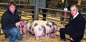 |
|
2012 - John Midgley (left) of Dean House Luddenden Foot, pig breeder |
Midgehole
A District of Calderdale north of Heptonstall. A little west of Hebden
Bridge following Midgehole Road stands Midgehole, a hamlet which appears
in early records of the 1300's for the West Riding. It is also an access
to Hardcastle Crags.
Booth
In 1848, Robert Midgley of Booth, Midgley is recorded as
voting for a Knight of the Shire.
In the 1881 census the following entry appears:
Dwelling: Booth Terrace
Census Place: Midgley, York, England
Source: FHL Film 1342056 PRO Ref RG11
Piece 4418 Folio 77 Page 14
Marr Age Sex Birthplace
Squire MIDGLEY M 26 M Midgley, York, England
Rel: Head
Occ: Stone Quarry Man
Hannah MIDGLEY M 26 F Midgley, York, England
Rel: Wife
Fred MIDGLEY 1 m M Midgley, York, England
In the 1901 census
at 31st March, Squire Midgley b~1854 in Midgley, resided at Booth and described
himself as a farmer and stone merchant. His wife Hannah (nee Greenwood?) was
born about 1855 and they had five children at this time:
1. Anne, Laura Midgley.
2. Evelyn, Greenwood Midgley.
3. Hilda Midgley.
4. Albert, Edward Midgley.
5. Lilian Midgley.
Pace Egging
Midgley is the venue for the traditional "Pace Egg Play" An ancient
custom [Spring Rite] which is being brought back into fashion by the boys
of Calder Valley School, Mytholmroyd. The Play was formerly performed in
nearby Midgley where the detail of the tradition was best maintained, particularly
the beflowered and beribboned headresses19. From Good Friday
the boys tour the local villages including Heptonstall, Midgley, Todmorden,
Luddenden and Halifax. The word "Pace" derives from the Latin word "Pacha"
which means Easter. It is traditionally performed by a group of men called
the "Pace -eggers".
Pace-egging is thought to relate to the ancient mumming plays. Each
man or Jolly-boy, would adorn himself with brightly coloured ribbons, animal
skins, rags and strips of paper the reason for which seems to go back to
The Crusades. Dramas are enacted by young men and boys often involving St.
George, a formalised battle, death, revival by a comic doctor [see photo]
with alms being collected at the culmination of each play19.
One of the men would blacken his face with coal or soot, and carry a
woven basket on his arm. The group of men then began to process through
the village whilst celebrating the Easter revelries with the community.
The idea is that he and his merry fellows goad the people into tossing eggs
into the basket. The eggs were often wrapped in onion skin and boiled to
give a mottled effect, being eaten for Easter breakfast on Easter Sunday.
The black-faced male is traditionally known as the "Old Tosspot". Other characters
include the "Lady Gay", the "Soldier Brave" and the "Noble Youth".
The Old Tosspot carried a long straw tail that had been stuffed
full of pins. He would swing it wildly about, acting as though he were
drunk, and wait for some poor unsuspecting fool to try and catch hold of
the tail or be tapped by it, all in good humour, but also to encourage people
to toss things into his basket. When the Pace-eggers received sufficient
eggs or money in the basket, the group would temporarily stop and present
a short play and dance. Usually an additional reward for the presentation
would be given to the group by a member of the public, such as a glass of
beer if performing outside a public house. Once the play was completed and
everyone was satisfied, the group would proceed through the area until the
entire village had been travelled. Normally the Pace-eggers would attract
quite a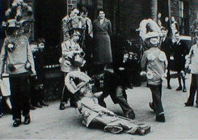 large group of followers by the end of their promenade as each presentation
was sure to be different and build upon the last
large group of followers by the end of their promenade as each presentation
was sure to be different and build upon the last
Here's one or two jolly boys all of one mind
We've come Pace-egging, I hope you'll prove kind
I hope you'll prove kind with your eggs and strong beer
And we'll come no more nigh you until next year.
Meeting a rival band of Pace-eggers could lead to a lot of competitive
friendly exchanges or "egging" with the passing of witty jibes between
the groups with occasional attempts to steal the eggs. Perhaps this is where
the expression "to egg someone on" originated.
Sometimes the groups would also have wooden swords that could also be
used to poke friendly fun at the rival group.The sword in England is said
to relate to St. George who is traditionally seen as a protector of justice.
It has been known for Pace-eggers to walk away with a couple of scratches
when the exchanges have become a little too over-enthusiastic as you might
expect!14
Rushbearing festival
Rushbearing in some form or other was carried out in many of the local
townships including Midgley, Sowerby Bridge, Ripponden,Triangle, Illingworth
and Brighouse which we know had a rushcart and which was revived in 1865,
being held the first weekend in September Saturday from 11am19.
Here at Warley Church the Rushcart is blessed and taken by clog wearing
villagers around Sowerby, Ripponden, Triangle and Cottonstones in the company
of the Bradshaw Mummers, Morris Dancers and other entertainers.
Rushbearing is the ceremonial taking of rushes to the churches to be
used as floor coverings, similarly threshings were used in households hence
the term threshold. Rushes were more biblical. The rushes were meant to
cover the church floor in winter. At one time this tradition was thought to have been confined to Lancashire
and some parts of Cheshire.
For centuries rushes have been used as floor covering but during the
1600's in the North West a very special festival developed, the centre of
which was the celebrated rushcart. Again as in egg pacing, rivalry between the supporters and builders
of different carts was sometimes intense and open brawls often developed
no doubt induced by the beer that was consumed. This caused many of the puritanical church ministers to refuse to allow
the rushbearers into the churches and it is from one such minded minister
Reverend Oliver Heywood that we have the earliest reference to rushbearing locally in 1682. From the Halifax Courier Aug. 12th 1865 we have: "This year it is intended
to honour the rushbearing with a rushcart, an event which has not taken
place for about 70 years. The cart in question will be made of rushes and
the top of it will be in the form of a beehive. Some say that it will be
ornamented with silver watches. It will doubtless prove a great attraction
as any of the side shows."
Rushbearing at
Sowerby Bridge 2009
Midgley has relics of a Pinfold where stray animals or sheep were held, stocks, a communal well ["Town Syke"] a stretchergate and
a workhouse15.
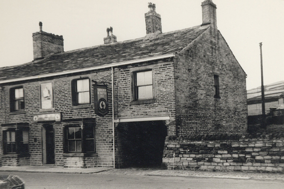
Public Houses that have existed in Midgley
White Lion Inn, Midgley Innkeepers: 1822: James Greenwood; 1845:
Abigail Patchett.
Mill Inn, Brearley Mill, Midgley
Royal Oak Inn, Midgley
Shoulder of Mutton Inn, Midgley
Woodman Inn, Booth, Midgley Innkeeper in 1845, Robert Midgley
Weaver's Arms
Other Inns in the district run by Midgley's:
Sportsman Inn, Kel Coat, Stainland Innkeeper 1845: William Midgley
Sportsman, Stansfield, Todmorden Innkeepers: 1822: William Midgley
and John Hargrave
White Lion Inn, Illingworth Innkeeper 1845: Ellen Midgley
Other settlements in the area
Stansfield (D.B.-Stansfeld)
O.E. personal name + feld meaning 'open land of a man called Stan' A town in the parish of Halifax only 12 miles from Rochdale in Lancashire
and ten miles from Halifax.
One of the earliest records in the world of the surname Midgley is used in
Pipe Rolls which are as follows:
Thomas de Midgley born circa 1154, probably of Stansfeld.
Mrs. Thomas de Midgley born about 1156.
Also Agnes Midgley born circa 1176 of Stansfeld.12
[These dates appear to be wildly inaccurate and
incorrectly determined from mentions of these persons in the Stansfield
Family History]
|
A study
of the appearance of the surname in West Yorkshire indicates a movement of
people towards Halifax. In the township lies Stansfield Hall
in the valley of Todmorden. It is here at Todmorden that three valleys meet,
one offers access to Burnley, the second to Rochdale and the third to
Hailfax. Todmorden was originally the seat of a Norman
who accompanied William I to England, Wyan Marmions who was
given land here by Earl Warenne. The Warenne's main seat was the castle of
Reigate with lands at Lewes in Surrey holding lordship over the
manor of Wakefield. Also within the township lies Field Head a farm-house. Stansfield has neolithic sites such as The Hawkstones and The Bride
Stone etc.
The Bride Stone consists of one upright stone or pillar, called the
Bride, which has a height of about five metres, a diameter of about three
metres and the pedestal is about half a metre diameter. Near this stood
another large stone called The Groom which prior to 1823 had been pulled
down by the locals. Not far away on the old Common are many large and small
rocks scattered about which Dr. Stukeley an antiquarian of the 1700's described
as 'something like a temple of the serpentine kind"5
Luddenden Dean
 A village on the stream of Luddenden Dean uphill from Luddenden, which
itself is uphill from Luddenden Foot.
A village on the stream of Luddenden Dean uphill from Luddenden, which
itself is uphill from Luddenden Foot.
Some individuals are mentioned as living in Luddenden Dean in 1850.3
1. Thomas Midgley ,Victoria House Shop.3
2. John Midgley [John o’ the Lords], Nunnery Farm.3
3. Jonathan Midgley, Clough Farm Cottage.3
batchelors.
4. Peter Midgley, Fulshaw Farm. 2 persons
Luddenden
Luddenden is so deep in Calderdale that the sun does not find it after
October7. St. Mary's is the Luddenden chapel in the township of
Midgley was
built about 1496. The church was consecrated in August 1624 by two priests,
the Reverends Greenwood and Walsh the service being attended by James Murgatroyd,
William Midgley, Thomas and Jasper Lacy, Gilbert Deane and Gregory Patchet. The Church was rebuilt in 1814-1816
on the same site.18

Luddenden Foot.
Is situated on the Calder river, it is protected from the northerly
winds by Midgley Moor. Paper making was in full swing at Dean Mill on
Luddenden Brook in 1726 where two water mills were evident, one for the glazing
mill. Another mill was called the 'Vicarage Mill', a fulling or paper mill so
called because John Midgley granted the rent he gained from it to the curate of
Luddenden while his brother William gifted a loft to the church. By 1792
Jonathan Bracken and Sons, who had purchased the mills, were now paper makers in
the Dean until 1921.36 Luddenden Foot was developed faster than Luddenden
with the arrival of the Rochdale canal (1794-1802) from Sowerby Bridge to
Manchester and later extended in 1828 to Halifax.
The earliest church register of Midgley names given for the township
of Midgley were Anthony, Richard and William 10. The earliest marriage given here is between John and Isabella Midgley
4th February 1541. Common first names for males were John, Thomas, William, Robert and
Richard and for females, Agnes, Isabella, Elizabeth, Anne, Marion, Margaret
and Alicia.
At Luddenden Foot, a canal runs from Littleborough to Todmorden which
passes through Sowerby, Luddenden Foot and Hebden Bridge. This canal was
used to help construct the railway at Hebden Bridge and Todmorden. The
canal had a "basin" at Luddenden Foot where the bargees ("boaties") tied up.
They would stay overnight at one of the three taverns here, The Woodman,
The Weavers Arms and The Anchor and Shuttle.
There was also a corn mill by the canal in the 1800's owned by George
and William Thompson with mills on the hilltop at Midgley which were owned
by Ely Titherington who was a wealthy worsted spinner. Ely and his son
James also owned a house called Old Ridings overlooking the Luddenden Valley. Luddenden Foot is probably best known for its association with Branwell
Bronte the unfortunate brother and artist of the Bronte sisters of Haworth. In the 1800's Branwell Bronte who was working as a station master at
Luddenden Foot railway station, frequented the Lord Nelson Inn with
the Luddenden Reading Society. Some of the members were9:
Timothy Wormald, the landlord of the Lord Nelson and clerk
to the church across the way. John Whitworth a mill owner
at Longbottom on the canal, who owned a fine residence called Peel House
beyond Luddenden.
John Garnett, a manufacturer of Holm House.
Francis Grundy, a railway engineer (Richard Grundy drove the
first train from Manchester to the Calder Valley.)
William Heaton a handloom weaver of Luddenden.
Francis Leyland a printer.
William Wolven, a ticket collector
G. Thompson, a corn merchant.
John Murgatroyd, a wealthy woollen manufacturer of Oats Royd,
Luddenden. He employed the Liverpool Irish in his mills. Many Irish worked
the mills and canals (Cols, Colls, Killiners and McColls).
George Richardson the wharfinger of Sowerby Bridge (controlled
the warehouses and Wharfs)
Branwell Bronte lodged at Turn Lea cottages ('up t' hill'). His
bedroom window overlooked the Ewood Estates at Midgley, once owned by John
Grimshaw who inherited Ewood when he was twelve from his grandfather. Later
it was inherited by John Crossley of Caitcliffe Hall. Branwell also lodged at
Brearley Hall. By the end of March 1842 Branwell Bronte had been dismissed from his
post as station master at Luddenden Foot. (The railway had arrived in 1840)
Kershaw House at
Luddenden Foot
According to Watson in his History of Halifax, Kershaw House was erected
by the Midgleys of Midgley in 1650 adding that 'at one time a family of some
repute here bearing arms'*.30 The house stands on the site first mentioned in the Wakefield Manor Court Rolls
of 1307^ when it was known as Kirkshaugh ['Kirkshaw'], an Anglian word meaning church
copse. These rolls also mention a 'John Kirkeshaghson' in 1331 and Alan and
John de Kirkeshage in 1339. According to Watson the later Kershaw House built on the same site
was built by the
Midgley family in 1650.27 [Though some erroneously say 1605]
Other sources say that Kershaw House was built in 1650 under the direction of James Murgatroyd
who purchased land here in ?1640.The Oldfield family may have been here earlier
as the York Index of Wills gives the name of Thomas Oldfield of Kershea House
(sic), Midgley who wrote his will in 1635. Midgleys were intermarried with the
Oldfields earlier in the second half of the 1500's. (See Magson House, this
page.)
Below: Chart of the relationships between Midgley of Thornton &c., and
Murgatroyd of East Riddlesden &c.
.
 There are two double story porches one with a rose window above
and another with a priest hole a secret chamber often used in houses of this
age which was built as a hiding place for Catholic priests after they had
been proscribed or banned by Henry VIII. The rose window was added in 1650 by Thomas Murgatroyd and his wife
Anne who left their initials carved in stone beneath the window. Legend
has it that two nuns who were decapitated here can be seen each year riding
in a carriage up the hill to the house.
*However despite Watson and Crabtree's
assertions this statement appears to be incorrect, the present Kershaw
House was built for Thomas Murgatroyd and his wife Anne whose initials appear
above the front porch. It may be more correct to say that this was the site of a
pre-existing house occupied by the Midgley family.
There are two double story porches one with a rose window above
and another with a priest hole a secret chamber often used in houses of this
age which was built as a hiding place for Catholic priests after they had
been proscribed or banned by Henry VIII. The rose window was added in 1650 by Thomas Murgatroyd and his wife
Anne who left their initials carved in stone beneath the window. Legend
has it that two nuns who were decapitated here can be seen each year riding
in a carriage up the hill to the house.
*However despite Watson and Crabtree's
assertions this statement appears to be incorrect, the present Kershaw
House was built for Thomas Murgatroyd and his wife Anne whose initials appear
above the front porch. It may be more correct to say that this was the site of a
pre-existing house occupied by the Midgley family.
^ WCR 1307- 'Adam
de Kyrkeschawe', 'Kirkeschagh', 1308 'del Kirkeschagh,' In 1307Adam
de Kirkeschagh drew blood of William son of William of the
same [de Kirkeschagh]
The priest hole lies inside one of two double storey porches. The second
porch at the front has a rose window. The rose window may have been added
in 1650 by Thomas Murgatroyd and his wife Anne, who left their mark by
carving their initials T.M. A.M. in a dated stone beneath the window. There are bee holes (bee hives) which are in the wall over which a basket
was placed so a honeycomb could be formed. A bee
hive is recorded in Luddenden Dean in 1313 when John the Miller was found
guilty of cutting a swarm of bees from an oak tree.35
The building now has a grade
one rating by the Historic Buildings Commission. The Murgatroyd family also built East Riddlesden Hall in the 1600's
which similarly boasts a rose window. The East Riddlesden property covered
over 200 acres and is the birth place of Dennis Healy a cabinet minister
in the Labour government of the 1980's.
In 1538 names were beginning to be officially recorded in parish registers.
See Midgley
names for Parish Register of Halifax
 It may be that the Midgley family at Kershaw House were not supporters of
Charles I and gained the Kershaw estate in the Great Civil War (1642),
when Oliver Cromwell removed Catholics from their properties and installed
Protestant owners. A physician, Dr. Samuel Midgley of Luddenden [d.1695]. was
in prison for debt three times
at Halifax, during his time in jail he wrote a "History of Halifax -
The Halifax Gibbett in its True Light". Whilst in jail he met Oliver Heywood,
he later died in Halifax jail. The book was published after his death
by William Bentley. It may be that the Midgley family at Kershaw House were not supporters of
Charles I and gained the Kershaw estate in the Great Civil War (1642),
when Oliver Cromwell removed Catholics from their properties and installed
Protestant owners. A physician, Dr. Samuel Midgley of Luddenden [d.1695]. was
in prison for debt three times
at Halifax, during his time in jail he wrote a "History of Halifax -
The Halifax Gibbett in its True Light". Whilst in jail he met Oliver Heywood,
he later died in Halifax jail. The book was published after his death
by William Bentley.
Another unfortunate resident of Luddenden Dean was a Methodist preacher,
Thomas Midgley [1814-1897] who is recorded as dying after falling over
a wall on his way home from an evening prayer meeting.
The descendants of Edward Midgley seated at Kershaw Hall
gradually migrated their land holdings N.E. to the Arthington / Adel area in
Wharfedale. Their pedigree is shown by Thoresby in his 'Topography' p. 21:

|
 |
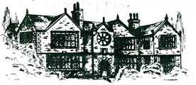
| Kershaw House, Luddenden - Which according to Watson
was the residence of the
Midgleys of Midgley township erected by this family.27, 30
|
From Thoresby's Ducatus Leodiensis 1714: Pedigree of the armigerous Midgleys whose progenitor,
Edward Midgley resided at Kershaw House, Luddenden. This pedigree
is part of Princess Catherine, countess of Cambridge's ancestry. From
the 29th October 2011 it has been decided at a CHOGM that the first
born, whether male or female, will take the throne. See West
Yorks |
In 1825 Robert Midgley (sen.) and Robert Midgley (jun.) were both
mentioned as trustees of the Luddenden Church16. In the churchyard
there is a headstone to Robert Midgley which has re-used an earlier sundial,
the original in recycling.21 There is also the oldest gravestone
in the churchyard belonging to a Midgley dated 1625, one year after the
church was consecrated.21
LORD OF THE MANOR OF MIDGLEY20
" THE Lord
of the Manor of Midgley, Thomas Fawcett
Riley
of Ewood Hall, Mytholmroyd, died in
December
[1928], aged 68.
A bachelor,
he was of a quiet, retiring disposition and had never
taken
an active part in public affairs although he contributed
quietly
to various charities. He was also connected with
Mytholmroyd
Church.
In
earlier years, he was a well-known hunter in the East Riding and
was
also fond of shooting, although failing eyesight later forced him
to
give it up.
He
was the owner of Midgley Moor and of the Ewood Hall estate,
which
included adjoining farms, and part owner of Bracewell Hall
estate,
Skipton-in-Craven, where he did most of his entertaining of
friends".
"Ewood Hall had a very long history, but was demolished in the early 1970s.
However there is a photo of the hamlet of Ewood and cottages which stood
close by the hall in a booklet of local walks. In 1881 the lord of the manor was one Thomas Riley. He is mentioned
in the booklet as having bought Ewood Hall in 1850. He also built many
of the properties in the vicinity and they still bear his initials on the
walls. Apparently, John and Charles Wesley both preached there in 1752 and
Royalist troops camped at Ewood prior to the Battle of Heptonstall in the
Civil War in 1643"13
Magson
House is sited near Luddenden. Richard Midgely / Mydgley b~1546 married
Jane Oldfield. By 1582 Richard was residing at
Roebucks, Luddenden and by 1595 held the estate.
Pedigree Chart of Richard Midgley with the Oldfields of Magson,
Roebucks and Greystones, Luddendenfoot
.
Magson House was then sold in 1715 by his heir Robert. Another
Richard Midgley b~1563 married a Christabel Oldfield in 1586 [Halifax Registers]. Christabel
Ouldfielde
(sic) married in 1570 William Midgely (sic) b ~1544. They resided at Roebucks
in 1582 having had a daughter, Mary, in 1579.
Roebucks, Luddenfoot/Warley. Originally a timber structure is
mentioned in a Grieve List in 1491 when it was held by John Oldfield, being
passed to his heir Thomas (1545) and to his heir John Oldfield. who sold
Roebucks in 1592. In 1608 Roebucks was occupied by William Midgley who was
succeeded by his son Richard and his son Abraham (1624). In 1613 Richard Midgley
was recorded as a yeoman clothier with a tenterfield and loom chamber where
woollen cloths and shalloons were produced. In 1630 Roebucks was sold by Abraham
Midgley to Edmund Tattersall when the wooden building was apparently demolished
and replaced with stone. The initials of Edmund and his wife (1633) are carved
above the porch.
Mytholmroyd
Lies deep in Calderdale on the river Calder.
O.E. (ge)mythe (dative plural) (ge)mythum+rodu, meaning 'clearing
at the river-mouths'.
Mythomrode in the 1200's2. The name Royd which is found throughout
Yorkhire has its derivation in 'rode'. Terra bovata and Terra rodata (rode)
were two types of land under plough (oxgang land). Rode became Royd (='rid')
meaning to clear or grub. Royd is almost as common as a place-name suffix
as -field ('felled') or close ('enclosure')4.
Sowerby Bridge ( 1086 D.B. - Sorebi)
In the 1400's recorded as Sourebybrigge. This township had an important
role to play as a bridging point across the Calder river.
About 1558 Richard Midgley of Sowerby died
and was buried at Halifax Parish Church. His wife was Elizabeth and they
had at least two children, Elizabeth and Margaret.39
See Heptonstall
and Todmorden
Warley ( 1086 D.B. - Werla)
Also recorded as Werlei. A town in the Parish of Halifax, Liberty
of Wakefield. About 2.5 miles from Halifax. Also one of the 9 Berewicks
in the Manor of Wakefield. Under the school are the old Midgley/Warley prison
cells which have three exits!
Ovenden
O.E. personal name+denu meaning'valley of a man called Ofa'
In 1219 recorded as Ovenden.
The earliest recorded Midgley here is the marriage of John Midgley to
?Alicia Midgley in 155410.
Thornton by Bradford (1086 D.B.- Torentone)
O.E. thorn+tun meaning 'thorn-tree enclosure or farmstead' Another Midgley manor was
situated here.
Todmorden (1246-Tottemerden)
O.E. Boundary valley of a man called Totta pers. name+maere+ denu
One Todmorden vicar was a Joseph Midgley who succeeded his father, Richard
Midgley (b.1500's).Apparently he had more extreme Puritanical views than
his father.
The Gibbet
In records for the late 1500's it is common to see references
to "heading" in Halifax which refers to persons being beheaded at the "Halifax Gibbet" the
precursor to the French guillotine but long used here to deal with woollen
cloth stealers and "coiners".
Richard Midgley was beheaded at Halifax gibbet 13th April 1624, but
on the side of the law is John de Midgley, Constable of Midgley in
1371 (Wakefield Rolls) and Robert Midgley was a Constable at Northowram
1849-1850.
 Sources/References:
1. Thomas Langdale, A Topographical Dictionary of Yorkshire,1822,
TheWest Riding
2..A.D. Mills, Dictionary of English Place Names, 1997,
O.U.P.
3.Thomas Langdale, A Topographical Dictionary of Yorkshire,1822,
TheWest Riding
4.History of Cawthorne Charles T. Pratt, 1882
5.Baine's Directory of The County of York, 1823
6. W. Midgley, Sunshine on the Howarth Moors,1950..
7. Daphne du Maurier, The Infernal World of Branwell Bronte.
8. G. Dent, Ewood in Midgley, Trans.of the Halifax Antiquarian
Soc.7th Feb. 1839
9. List of members of the Luddenden Library in 1840 (now at the
Sowerby public library)
10. Births, Deaths and Marriages, Parish of Halifax, Vol 2-37
11. I.A. Richmond, Huddersfield in Roman Times,Wheatley, Dyson
& sons 1925.
12. International Genealogical Index 1994. Although some doubt can be cast
upon the years given in the I.G.I. see Early
names
13. Roy Stockdill via Yorksgen email list.1999.
14. WWW Mystical Months.
15. John Franklin Midgley, Midgleyana, Cape Town, 1968,
p.51a
16. Ibid p.52
17. Ibid. p.36
18. Ibid. p.24 [From taxation returns of 1300's]
19. Brian Day, A Chronicle of Folk Customs, Hameln, 1995.
20. Halifax Evening Courier, 1929.
21. e-mail comm. Paul Hesketh
March 2003
22. Personally I think this to be a glacial erratic- It does not appear
to be composed of Millstone Grit, the local lithology. It seems to display
quartz veining, jointing and greenstone facies [olivine] mineralisation.
This is typical of a pre-existing igneous plutonic material whch has undergone
low grade metamorphism. The source for such could be Northern Scotland
or perhaps from as far away as Norway! Since the last [Wurm] glacial retreat
about 12000-10000 years ago the boulder has spalled scree around itself
probably as a result of ice wedging [the scree is very angular and large].
Of course there may have been some human activity in the intervening period,
but the isolated position of these stones and local bad luck omens may have
saved them from builders cannibalising or vandalising them.
23. E-mail comm. with Peter
Evans April 2003
24. Seller, Gladys. Walking in the South Pennines. Gladys did
not give a name to this stone but provides a photogrph of it.
25. Crabtree,
John . A Concise History of the Parish and Vicarage of Halifax.1837, pp.
424-425.
26. Cal. Inq. p.m. vol. 2, 1906, pp.383-394.
27. Crabtree,
John. Concise History of the Parish and Vicarage of Halifax. 1836. p.
429.
28. Ibid. p. 414.
29. Watson, John.
The History and Antiquities of the Parish of Halifax. p. 108.
30. Ibid. p. 429.
31. Foster J. Feudal
Coats of Arms. 1902, reprinted 1995, p. 169.
32. Poulson,
George. The History and Antiquity of the Seigniory of Holderness. vol. I, 1840. p.
46.
33. Calendar of Close Rolls, Richard
II: volume 1: 1377-1381 (1914), pp. 239-246.
34.
Turton, The Honour and Forest of Pickering. vol II. 1895, p. 245.
35 Wakefield Court
Rolls, 1313-1316, p. 7.
36. Research
by Peter Bond.
37. Crossley,
E.W., (Ed.), Halifax Parish Wills, vol. II, 1545-1559, p. 109.
38. Ibid., p. 130.
39. Ibid., p. 161.
40. History of
Todmorden. p. 70.
41. Ibid.
42. W.C.R., vol.
1, p. 94; Lister, John
(Ed.), Court Rolls of the Manor of Wakefield, vol. 4, 1315-1317, x.
43. Poll
for a Knight of the Shire. (1848).
Wakefield Court Rolls Series:
The Wakefield Rolls are parchment or skins sewn together to form
rolls they date from 1274.
Translations of the Wakefield Manor Court Rolls by The Yorkshire Archaeological
Society:
1.Sue Sheridan Walker (ed.), The Court Rolls of the Manor of Wakefield
from October
1331 to September 1333 (1983)
2.Moira Habberjam, Mary O' Regan, Brian Hale (eds.), The Court Rolls
of the Manor of
Wakefield from October 1350 to September 1352
(1987) With Introduction by C M Fraser
3.Ann Weikel (ed.), The Court Rolls of the Manor of Wakefield from October
1537 to
September 1539 (1993)
4.Ann Weikel (ed.), The Court Rolls of the Manor of Wakefield from October
1550 to
September 1552 (1989)
5.Ann Weikel (ed.), The Court Rolls of the Manor of Wakefield from October
1583 to
September 1585 (1984)
6.C M Fraser (ed.), The Court Rolls of the Manor of Wakefield from October
1608 to
September 1609 (1996)
7.Lilian Robinson (ed.), The Court Rolls of the Manor of Wakefield from
October 1651
to September 1652 (1990)
8.Constance M Fraser, Kenneth Emsley (ed.), The Court Rolls of the Manor
of Wakefield
from October 1664 to September 1665 (1986)
9.Andrew Brent, B J Barber (ed.), The Court Rolls of the Manor of Wakefield
from
October 1790 to September 1792 (1994)
forthcoming volumes:
K Troup (ed.), The Court Rolls of the Manor of Wakefield from 1338
to 1340 (1998)
J Addy, A Young (ed.), The Court Rolls of the Manor of Wakefield
from 1378 to 1380
Enquiries should be addressed to:
Hon General Editor
c/o Yorkshire Archaeological Society
Claremont
23 Clarendon Road
Leeds LS2 9NZ
Other useful sources/references if you can get to see them:
*Dom Boc. A Translation of the Record called Domesday as far as it
relates to the County of York. Revd. W. Bawden, Doncaster, 1809.
*Dodsworth Manuscripts, Bodleian Library, Oxford.
*Extract of Dodsworth MSS Yorkshire Archaeological Journal Vol 2 1871-2
*Pedigrees of the County Families of Yorkshire, Vol I West Riding,
Joseph Foster, London 1874
*Leyland's Itinerary 1535-1543 ed. Hearne 1714.
*The Book of Poll -Tax, West Riding, Yorks. Archaeol. Soc. 1882.
*A list of Roman Catholics in the County of York 1604, E. Peacock,
Hotten 1872.
*History of Halifax. Watson, 1741. Leyland, Halifax Ed.
*Pictures of the Past . F.A. Grundy, Griffith & Farrar 1879
*It Happened Here. Arthur Porritt
 Home
- where the whole site can be searched
Home
- where the whole site can be searched
Copyright © Tim Midgley All links revised 4th July, 2025.
|


